Analysis of Spatial Concepts, Spatial Skills and Spatial Representations in New York State Regents Earth Science Examinations
Kastens, K. A., Pistolesi, L., & Passow, M., J. (2014, May). Analysis of spatial concepts, spatial skills and spatial representations in New York State Regents earth science examinations. Journal of Geoscience Education, 62 (2), 278-189.
ABSTRACT: Research has shown that spatial thinking is important in science in general, and in Earth Science in particular, and that performance on spatially demanding tasks can be fostered through instruction. Because spatial thinking is rarely taught explicitly in the U.S. education system, improving spatial thinking may be ‘‘low-hanging fruit’’ as far as improving science education. In this paper we have analyzed, categorized, and quantified the occurrence of items that require spatial thinking on New York State’s end-of-course exam for high school Earth Science. Analyzing all items across 12 exams (1,016 items total), we find abundant instances of spatial concepts, spatial skills, and spatial representations, with 63.1% of the items being coded into one or more spatial categories. In an associated pilot study of item difficulty on one exam, we find that students on average scored lower on items that we had coded as spatial than on items we had coded as nonspatial. In the short run, these findings should motivate Earth Science teachers to attend more deliberately to fostering spatial thinking in their instruction. In the long run, findings such as these can be used in crafting targeted professional development based on an analysis of what types of items an individual teacher’s students have found to be difficult.
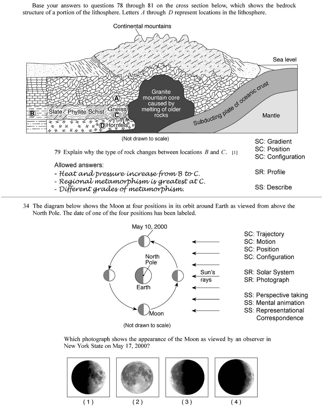
Figure 2. Example items, annotated with their spatial subcodes. Both examples shown have subcodes in all three categories. SC: code for a spatial concept; SR: code for a type of spatial repesentation; SS: code for a spatial skill.

